CORSICA

CHALLENGE 9

WALK THE SPINE OF CORSICA

CHALLENGE METRICS

Duration
Duration icon
12 Days
Mode
Mode icon
Skiing
Distance
Distance icon
111Km
Price
Price icon
$82,000 USD
Dates:
Dates: icon
December
Location:
Location:  icon
Antartica
Challenge Information:
Challenge Information: icon
Click to download file
ENQURIE NOW

CHALLENGE METRICS

Duration:
Duration: icon
14 Days
Mode:
Mode:  icon
Walking
Distance:
Distance:  icon
180Km
Price:
Price: icon
£3,995
Dates:
Dates:  icon
28th June - 12 July 2026
Location:
Location:  icon
Corsica
Challenge Information
Challenge Information icon
Click for more info
ENQURIE NOW

CHALLENGE METRICS

 icon
Duration: 12 Days
 icon
Mode: Skiing
 icon
Distance: 111Km
 icon
Price: $82,000 USD
 icon
Dates: December
 icon
Location: Antarctica
 icon
Challenge Information
ENQURIE NOW

CHALLENGE HIGHLIGHTS

This 180-kilometre traverse follows the mountainous backbone of Corsica, a route famous for its knife-edge ridgelines, alpine lakes, and remote high passes. With over 11,000m of elevation gain, the GR20 is a relentless test of stamina and spirit. 


The journey begins in the island’s northern highlands, where you meet your guide at the first gîte to receive a brief on the route and prepare your equipment for the expedition. You will pack for the following two weeks so that you can step off on the challenge with confidence and the right mindset. The next day, you start with a baptism of fire, with 1,360m of elevation gain over the first 11km. This is the first sign that this is not just a guided stroll. 


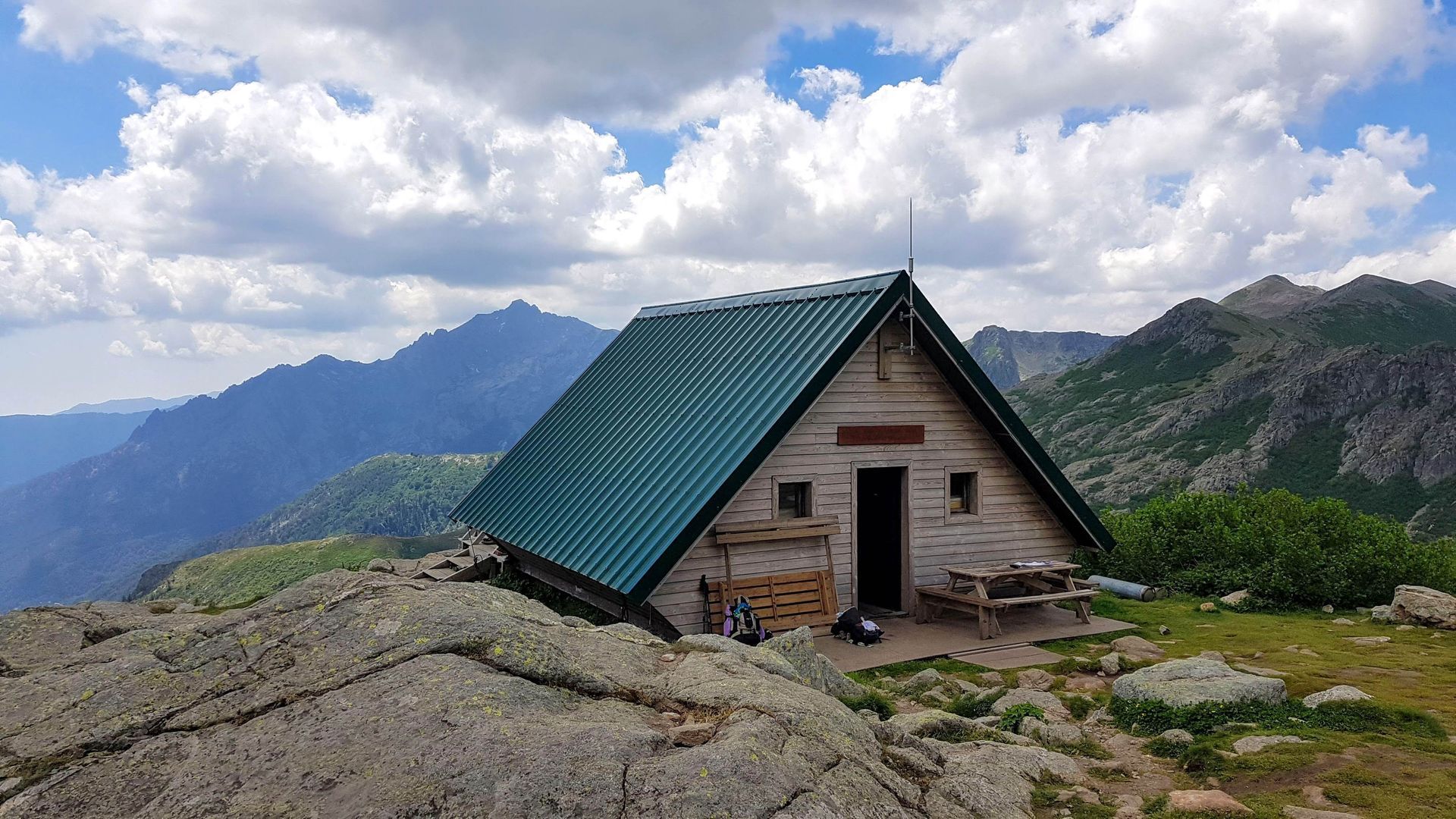
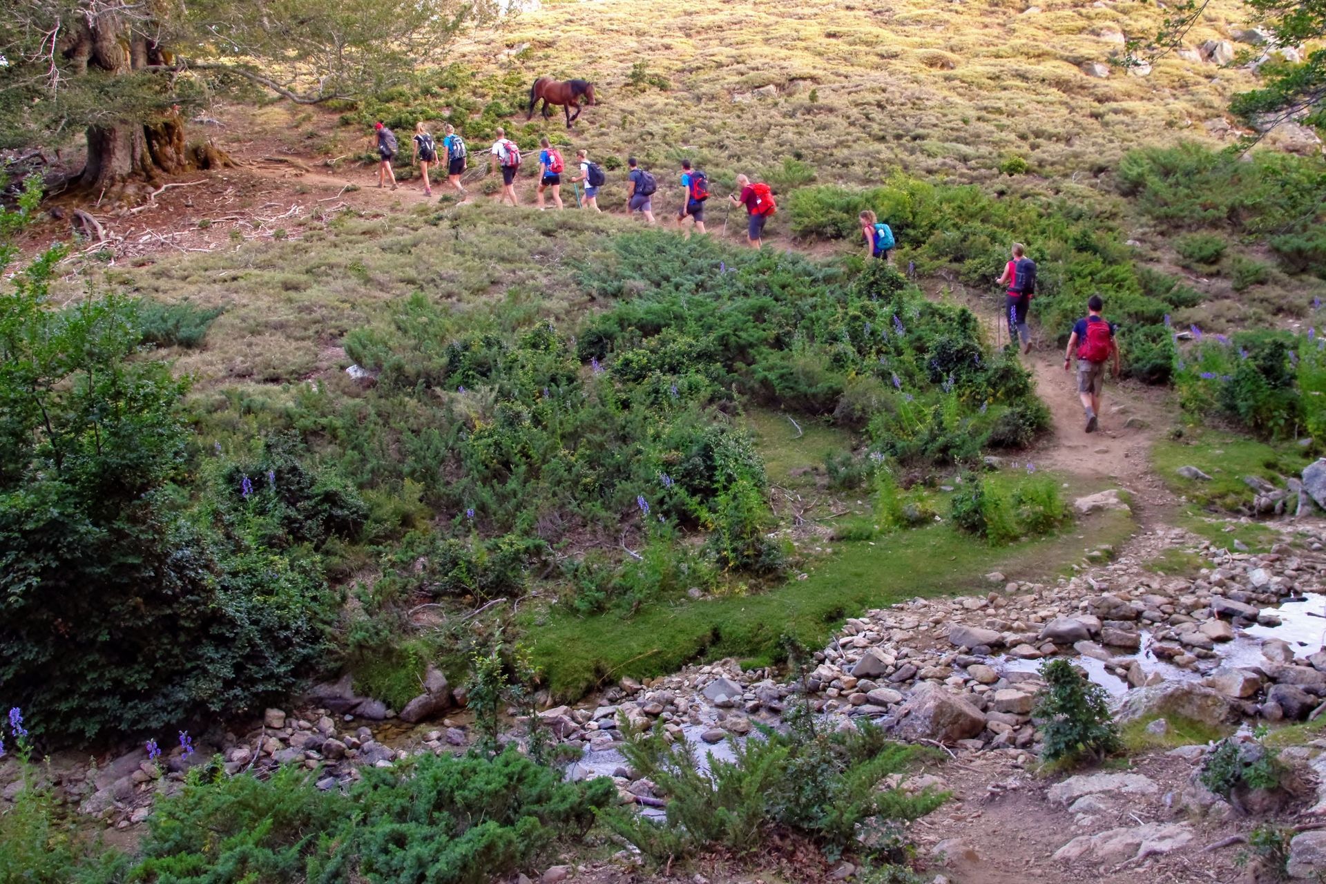
Over the following two weeks, the route climbs and drops relentlessly, with a total elevation gain that surpasses the height of Everest. You will link high refuges with exposed paths, boulder fields, and steep ascents. From Monte Cito to the Forest of Vizzavona, every section of the route is a new story and asks something different of you. On the trail, nights are spent in mountain dormitories or tents. 


Across 13 demanding days of trekking, you will be boldly crossing one of Europe’s most iconic long-distance trails. An experience that will strip life back to the essentials and leave you with a lasting sense of achievement. 

ITINERARY

Day 1 – Airport transfer to Calenzana.

Meet your guide in Calvi train station before a road move to the village of Calenzana. Settle into your first gîte, receive the expedition briefing, and prepare your pack for the coming days.


Day 2 – Calenzana to Ortu di u Piobbu.

11km · 6 hours · Ascent +1,360m · Descent -50m.

Start the GR20 uphill, climbing 1,360m in elevation to reach your first refuge perched at the top of the Bonifatu cirque.


Day 3 – Ortu di u Piobbu to Carrozzu.

7km · 7 hours · Ascent +750m · Descent -950m.

Begin in the high mountains, passing over ridges before descending over scree to your next refuge, nestled in the forest.


Day 4 – Carrozzu to Haut Asco.

7km · 5.5 hours · Ascent +800m · Descent -750m.

Cross forest streams before climbing to Col de la Muvrella and its lake. Stunning views open above the treeline before a pleasant descent to the ski resort of Asco.


Day 5 – Haut Asco to Tighjettu.

10km · 8 hours · Ascent +1,150m · Descent -1,200m.

Cross the highest part of the route, reaching 2,604m at Monte Cintu, the island’s highest peak. A long descent leads into the valley for the next refuge.


Day 6 – Tighjettu to Col de Vergio.

12km · 6.5 hours · Ascent +680m · Descent -710m.

Gentle forest paths lead to a steep ridge climb before reaching Col de Vergio.


Day 7 – Col de Vergio to Camputile.

15km · 6 hours · Ascent +750m · Descent -570m.

Pass through Valdu Nielu forest beneath magnificent beech trees, gradually climbing to a pass with breathtaking views of the west coast before crossing the plateau to your refuge.


Day 8 – Camputile to Onda.

16km · 9.5 hours · Ascent +1,130m · Descent -1,320m.

A demanding high-altitude stage across the Rotondo massif, passing lakes and high passes before descending to the refuge


Day 9 – Onda to Vizzavona.

10km · 6 hours · Ascent +710m · Descent -1,220m.

Begin with a gentle climb to the foothills of Monte d’Oro, then descend along the Agnone River to finish in the cool Vizzavona forest.


Day 10 – Vizzavona to Col de Verde.

28km · 9.5 hours · Ascent +1,210m · Descent -850m.

A long stage without technical difficulty but demanding in distance.


Day 11 – Col de Verde to Usciolu.

15km · 7.5 hours · Ascent +1,250m · Descent -850m.

Climb to panoramic views over the eastern plain and Costa Verde lakes, crossing granite landscapes before reaching your refuge.


Day 12 – Usciolu to Croci.

13km · 5 hours · Ascent +600m · Descent -820m.

Follow the ridge towards Bocca di l’Usciolu, with some chain-assisted passages, before gentler paths across the plateau to Croci.


Day 13 – Croci to Bavella.

15km · 8 hours · Ascent +780m · Descent -1,100m.

Cross the last major peak of the range before descending through the majestic granite towers of Aiguilles de Bavella.


Day 14 – Bavella to Conca.

18km · 7.5 hours · Ascent +490m · Descent -1,480m.

Follow shady trails toward the Cannone ravine before descending to Conca, where a bus transfer will take you to Figari airport.

Man in arctic turrain looking out over the woods of snow covered trees

What's included?

  • Accommodation from 28th June to 12th July 2026 
  • Group transfer from Calvi Airport to the Challenge start point 
  • Group transfer from the Challenge finish to Figari Airport 
  • An experienced Corsica-certified mountain leader 
  • Food from arrival on night 1 through to lunch at the finish point of the Challenge, including train snacks. 
  • Sleeping bag, hiking poles, and backpack. 
  • Porterage for follow-on bags, which you can access on certain nights of the Challenge. 

Plane flying over land

What's not included?

  • Flights to Calvi Airport or from Figari Airport 
  • Personal clothing and equipment 
  • Personal Travel Insurance 

FAQs

Full details in the information document.


Frequently asked questions we've received for this challenge from previous challengers.

If your question isn’t covered in our FAQs, we’re here to help — reach out below and we’ll get back to you soon.

ENQUIRE
  • Is this for me?

    You do not need any alpine experience to take on the GR20, but you do need to be ready. 


    This is a physically and mentally demanding route. You will hike up to 10 hours a day over steep, rocky, and often exposed terrain. The trail is unforgiving in places, with significant elevation gain, rough surfaces, and minimal facilities. Strong fitness and a commitment to preparation are essential.  


    If you’re ready for it, completing the GR20 is something that few forget. It’s a real accomplishment earned with every ascent, descent, and hard-earned view.  

  • How fit do I need to be for Challenge 9?

    This expedition requires a solid base of general fitness and a readiness to spend several hours outdoors each day. You don’t need to be a pro athlete but strong walking stamina is required.


    The fitness plan will assist you in your training.